


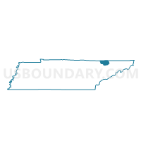
Sandlick Voting District, Claiborne County, Tennessee
About
Outline

Summary
| Unique Area Identifier | 668129 |
| Name | Sandlick Voting District |
| County | Claiborne County |
| State | Tennessee |
| Area (square miles) | 11.63 |
| Land Area (square miles) | 10.32 |
| Water Area (square miles) | 1.31 |
| % of Land Area | 88.72 |
| % of Water Area | 11.28 |
| Latitude of the Internal Point | 36.38128980 |
| Longtitude of the Internal Point | -83.68098280 |
Maps


Graphs
Select a template below for downloading or customizing gragh for Sandlick Voting District, Claiborne County, Tennessee


Neighbors
Neighoring Voting District (by Name) Neighboring Voting District on the Map
- 3-3 Brock Community Center Voting District, Union County, TN
- 5-10 Sharps Chapel Elementary Voting District, Union County, TN
- Goin Voting District, Claiborne County, TN
- Lone Mountain Voting District, Claiborne County, TN
- New Tazewell Voting District, Claiborne County, TN
Top 10 Neighboring County Subdivision (by Population) Neighboring County Subdivision on the Map
- District 2, Claiborne County, TN (4,764)
- District 3, Claiborne County, TN (4,730)
- District 3, Union County, TN (2,413)
- District 5, Union County, TN (2,243)
Top 10 Neighboring Place (by Population) Neighboring Place on the Map
Top 10 Neighboring Unified School District (by Population) Neighboring Unified School District on the Map
Top 10 Neighboring State Legislative District Lower Chamber (by Population) Neighboring State Legislative District Lower Chamber on the Map
Top 10 Neighboring State Legislative District Upper Chamber (by Population) Neighboring State Legislative District Upper Chamber on the Map
Top 10 Neighboring 111th Congressional District (by Population) Neighboring 111th Congressional District on the Map
Top 10 Neighboring Census Tract (by Population) Neighboring Census Tract on the Map
- Census Tract 401, Union County, TN (7,040)
- Census Tract 9706, Claiborne County, TN (4,190)
- Census Tract 403, Union County, TN (2,366)